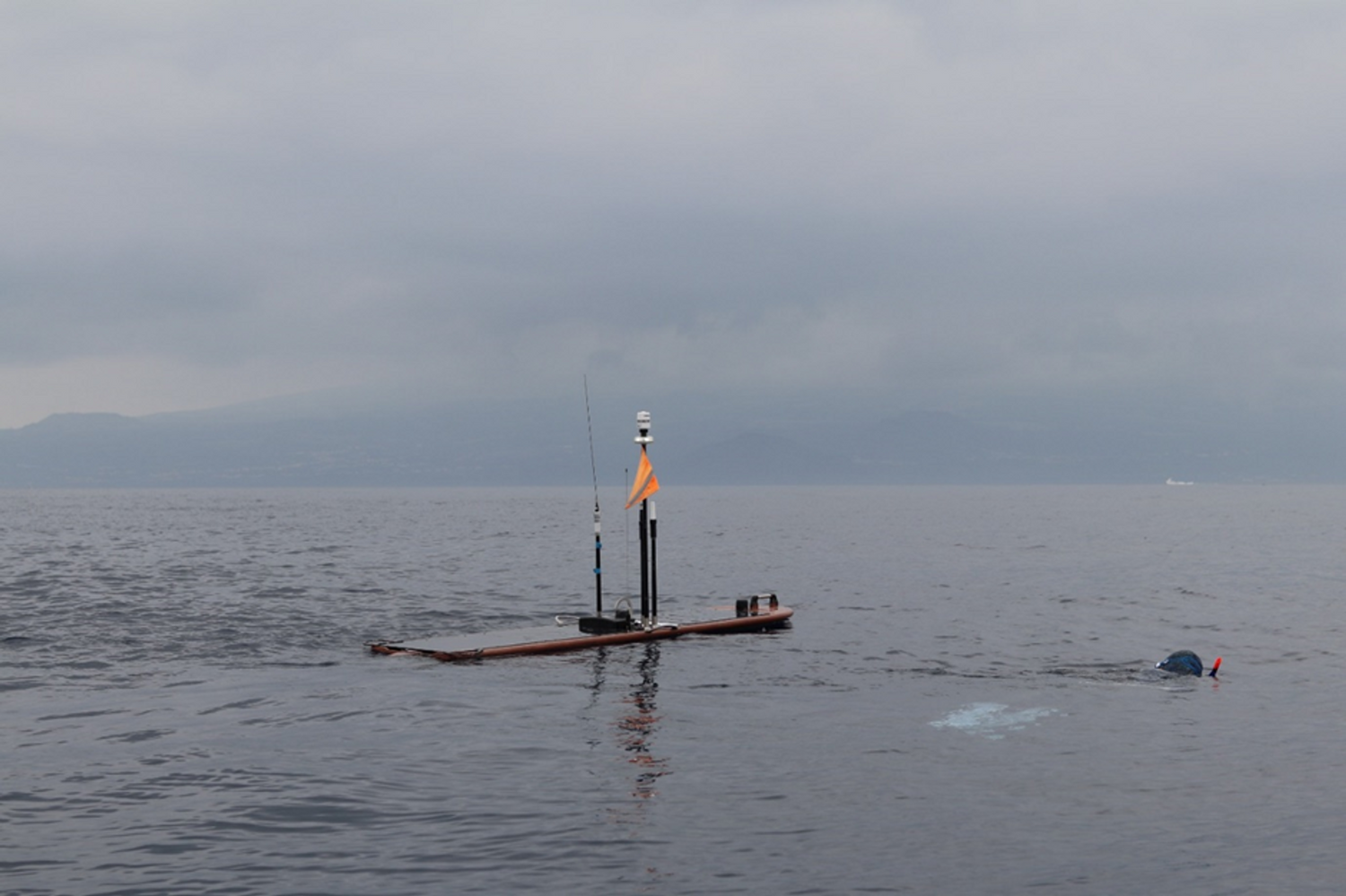
By Carlos Barrera (PLOCAN) and Caecilia Manago (ERINN Innovation), photo credit: Jorge Fontes (IMAR)
The MISSION ATLANTIC Wave Glider has been retrieved by PLOCAN in waters of Taliarte, Gran Canaria (Spain) in October 2023, after completing 1,200 nautical miles and 78 continuous days of scientific mission, after its launch on June 26 2023, in Horta, Faial Island Azores (Portugal). Through its journey (check out the Wave Glider Map), the Wave Glider collected 3D information on essential ocean variables (physical, chemical and biological), as well as map biodiversity and pressures in areas of special sensitivity in the North basin of the Atlantic Ocean.
The first successfully completed scientific mission by the Wave Glider was recently completed between the Azores and the Canary Islands. It is planned to be followed by a second route through Macaronesia to Cape Verde and then to onwards to Ascension Island. The last leg of the mission will then reach the coast of Brazil.
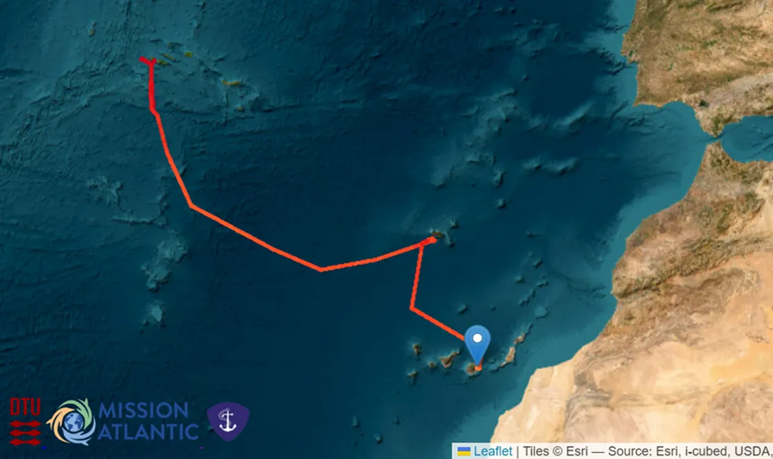
The first completed route of the Wave Glider between Azores Islands and Canary Islands
The Wave Glider is fitted with a payload of research equipment such as a weather station (AIMAR), conductivity and temperature probes (Valeport CT Sensor), dissolved oxygen (Aanderaa O2 Optode), partial pressure carbon dioxide (pCO2 Optode) and an echo sounder, as well as a pioneering sensor for monitoring and detecting fish and marine mammals (VEMCO) for selectively tagged species capable of providing new knowledge about their behaviour and survival.
Preliminary measurements of surface temperature in August 2023 show values up to 27ºC, well above recorded values at the same time in previous years in the same region.
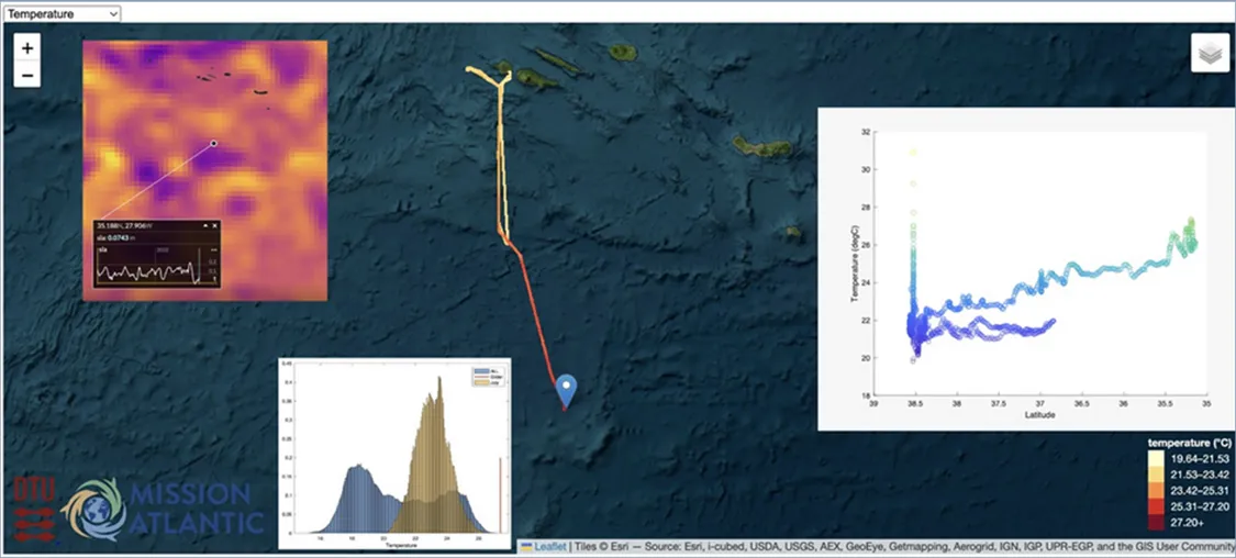
Wave Glider preliminary measurements of surface temperature
Check out O2- and CO2 concentration, salinity levels and temperature measurements across the Wave Glider Journey on the Wave Glider Map, by Fletcher Thompson (DTU)!
Through the planned journey and related data collection, it is expected that the Wave Glider can contribute to the expected impacts of MISSION ATLANTIC in terms of assessment and modelling through the mapping of pelagic ecosystems, resources and associated pressures on which to develop assessments and forecasts, and thus increase understanding of the vulnerabilities and associated risks. In this way, the goal is to generate better and more accurate monitoring, modelling, planning, management and prediction capabilities throughout the Atlantic basin.
The Wave Glider core operations team is formed by PLOCAN, Escola do Mar, OKEANOS/IMAR, Maritime Robotics, Technical University of Denmark (DTU), by supporting the Wave Glider piloting throughout the entire mission.