By Nils Piechaud (University of Plymouth)
Maps are an essential tool to summarise information needed for sustainable management. Providing that information and making it available for others to use, partners in MISSION ATLANTIC's WP4 have compiled and published a new report (Deliverable 4.2) on mapping, titled “Seafloor characteristics and benthic communities across the Atlantic”.
Habitat maps exploring the environment of the Atlantic Ocean and describing the distribution of Vulnerable Marine Ecosystems (VME) in different case-study areas (Celtic Sea, South Brazilian Shelf, and the Benguela Current) have been produced. This effort was accomplished with various and innovative data analysis methods including state-of-the-art modeling and automated image analysis with machine learning on very large datasets. Collectively, these models provide maps of the distribution of different VMEs in this case study region and will support future IEA assessments together with those already developed under other projects. Future research will be needed to validate the maps produced from model transfer to assess their accuracy and to determine the potential for this method to fill gaps in data-poor areas in the Central and South Atlantic.
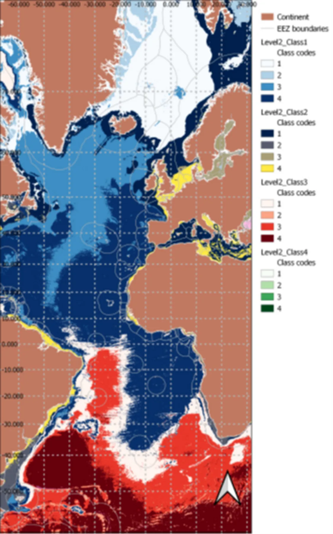
Hierarchical Approach level 2 classification. Each class from level 1 is split into several classes themselves coloured by shades of the same colours. Projection is WGS84 and Coordinates are in decimal degrees
Progress in the development of a low-cost seabed ground-truthing vehicle has also been shared, with trial use of camera systems on gliders aiming to provide biological data to inform or validate models developed for Mission Atlantic. Finally, this report gives an update on the task aimed at developing a standardized baseline of data on community structure and benthic cover for tropical oceanic islands in the South Mid-Atlantic Ridge where fieldwork is about to take place.
Read the full deliverable report D4.2 - Seafloor characteristics and benthic communities across the Atlantic here.