MISSION ATLANTIC will develop Integrated Ecosystems Assessments (IEAs) for seven regional Case Studies in the Atlantic Ocean. Here, Simone Pennafirme and Lohengrin Fernandes tell us about their recent research expeditions at the South Brazilian Shelf.
Case Study 7: South Brazilian Shelf (SBS)
From 2 February to 5 March 2021, researchers from the South Brazilian Shelf case study participated in two oceanographic cruises (H38-Cruzeiro do Sul and H40-Antares) along the continental shelf. The primary aim of both expeditions was to collect new data to create 3D maps of the pelagic zone or middle part of the water column. The maps will help us to visualise this part of the ocean and help us to better understand the processes, biodiversity, and pressures exerted on marine life here.
The team surveyed the area in transects, sampling the shallow continental shelf waters and down to depths of 1890 metres. The first survey, H38-Cruzeiro do Sul, focused on the area between Farol de São Tomé, Rio de Janeiro (22°00'38.5"S 40°59'09.8"W), and Cananéia, São Paulo (25°06'07.9"S 47°49'44.5"W). During the second survey, H40-Antares, we repeated the stations around Cabo Frio, Rio de Janeiro (22°52'55.7"S 41°53'17.2"W) to fine-tune the data.
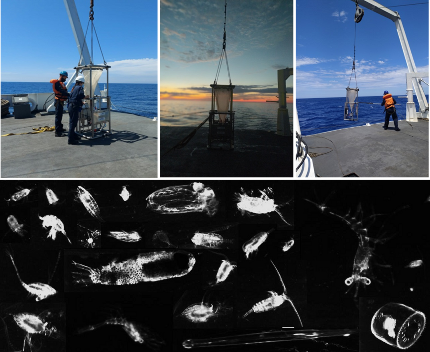
This year, we are most eager to learn more about plankton communities and we used the Lightframe On-sight Key species Investigation system (LOKI) to identify and analyse plankton species collected using a plankton net (pictured above). Using a CTD-Rossett, we collected data on the physical parameters of the water column (conductivity, temperature, and depth) and water samples for chlorophyll analysis as well as bacterio- and virio- plankton samples.
We are now busy planning the launch of a glider to further sample the Cabo Frio sector and collect more data for the 3D Pelagic Mapping!
Stay tuned to missionatlantic.eu for more news from SBS!